


Aquatic Services
Wetland and river habitat assessment, estuary integrity studies and GIS spatial analysis are all services provided by the SES aquatic specialist team. The assessments include wetland, river, and estuary health assessments, rehabilitation plans, water quality analysis, monitoring recommendations and compiling reports that clearly convey the findings and contribute to future management. Amongst other freshwater services, SES undertakes:
- · Desktop screening/risk assessments to inform clients of the probability of aquatic constraints on proposed development and discuss legislative requirements.
- · Water Use License Applications and Risk Matrix
- · Ground truthing, infield identification, and delineation of rivers and wetlands
- · Present Ecological State (PES), functional importance assessments and Ecological
- · Importance and Sensitivity (EIS) assessments of freshwater ecosystems.
- · Evaluating impacts to wetlands from proposed developments.
- · Identifying mitigation measures to limit impacts and calculating wetland offsets if required
- · Determining Resource Quality Objectives
- · Defining buffer zones for wetland, rivers, and estuaries.
- · Developing rehabilitation plans for wetlands
These aquatic services can be applied on a range of scales; from site specific river and wetland assessments for informing development applications to larger, regional/ catchment aquatic specialist studies to inform spatial planning and various types of biodiversity management plans. Our reports are of the highest scientific quality and produce practical solutions for effective implementation.


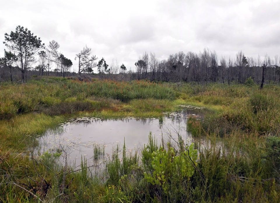
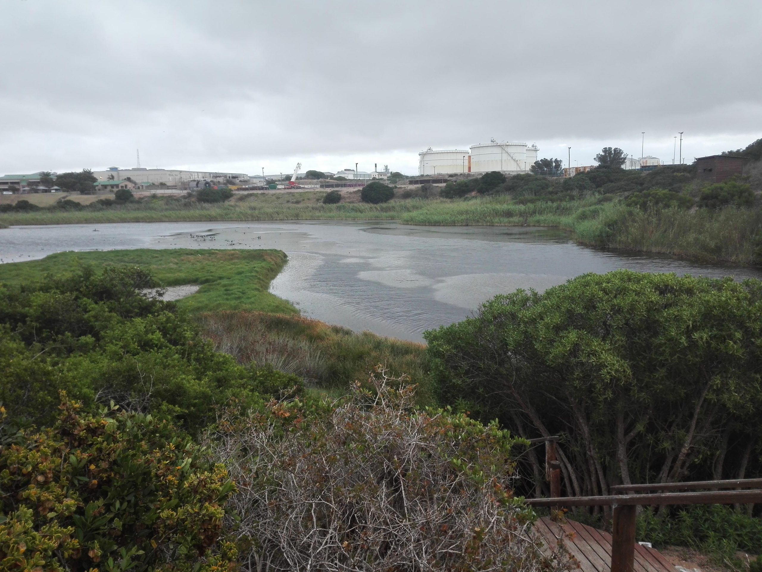
Wetlands
The National Water Act defines wetlands as:
“land which is transitional between terrestrial and aquatic systems where the water table is usually at or near the surface, or the land is periodically covered with shallow water, and which in normal circumstances supports or would support vegetation typically adapted to life is saturated soil”
The formation, size and persistence of wetlands are controlled ultimately by hydrological factors. For a wetland to form, one needs a surplus water supply at or close to the soil surface for a sufficiently prolonged period to cause anaerobic conditions in the rooting zone of herbaceous plants. Rivers and lakes also have excess water supply that leads to the creation of anaerobic conditions in the soil, but they either have fast flowing water (rivers) or are flooded to too great a depth (perennial rivers and lakes) to permit the colonisation of Macrophytic plants. Thus, for a wetland to form, saturation needs to be prolonged and shallow.
There are three key components that assist in determining the presence of a wetland. These include:
- Hydrology
This implies that the land is covered by water or has saturated soil at some time when the soil is biologically active. Saturated soil is that which contains sufficient water for long enough for reduction to occur.
- Saturated (reduced) soil
This implies that the soil is hydric. Hydric soil means that the soil has been depleted of oxygen through the chemical process of reduction, which in turn results in the presence of redoximorphic features, e.g. features formed by the process of reduction, translocation and oxidation of Fe and Mn oxides.
- Hydrophytic vegetation
This plant life is adapted to growing in saturated soils. Some plants have adapted to life in wetlands and are called hydrophytes (this means that they are “water loving”, or rather, anoxia tolerant). These specialized plants have adapted to grow in the anaerobic conditions of hydric soils.
The hydric soils are largely used in conjunction with the hydrology and vegetation characteristics to delineate the boundary of a wetland. There are 3 hydrological zones; Permanent, Seasonal, and Temporary zone. They are recognised by the presence of water and redoximorphic features within the soil matrix:
Mottled and Gleyed soils. Mottles are the red, yellow and black spots that are close to the soil surface in the seasonal and temporary wet zones of the wetland. Mottles are absent in the permanent wet area due to these areas being mostly void of oxygen (because of the relatively permanent presence of water) so that oxidation of the colourless Fe2+ to Fe3+ does not occur and soils are dull grey colours (Gleyed). In practice, therefore, wetlands are usually identified by applying the hydric soils criterion, while the hydrological and hydrophytic vegetation criteria are mostly used to confirm the finding of the hydric soils criterion. The soils are either gleyed (permanent zone), or mottles occur within the first 50cm of soil (temporary and seasonal zones).
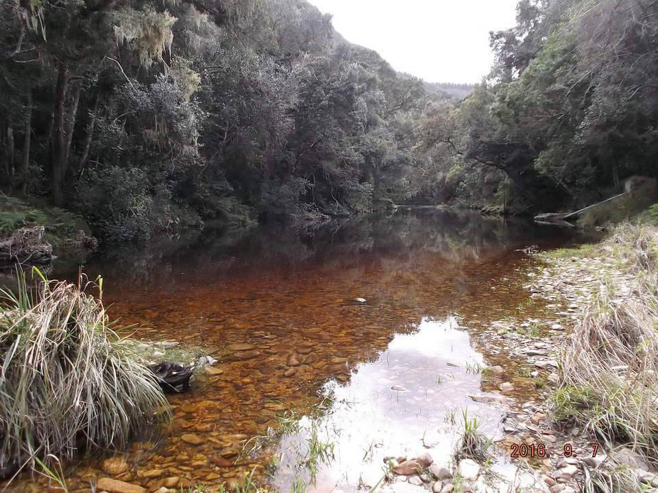
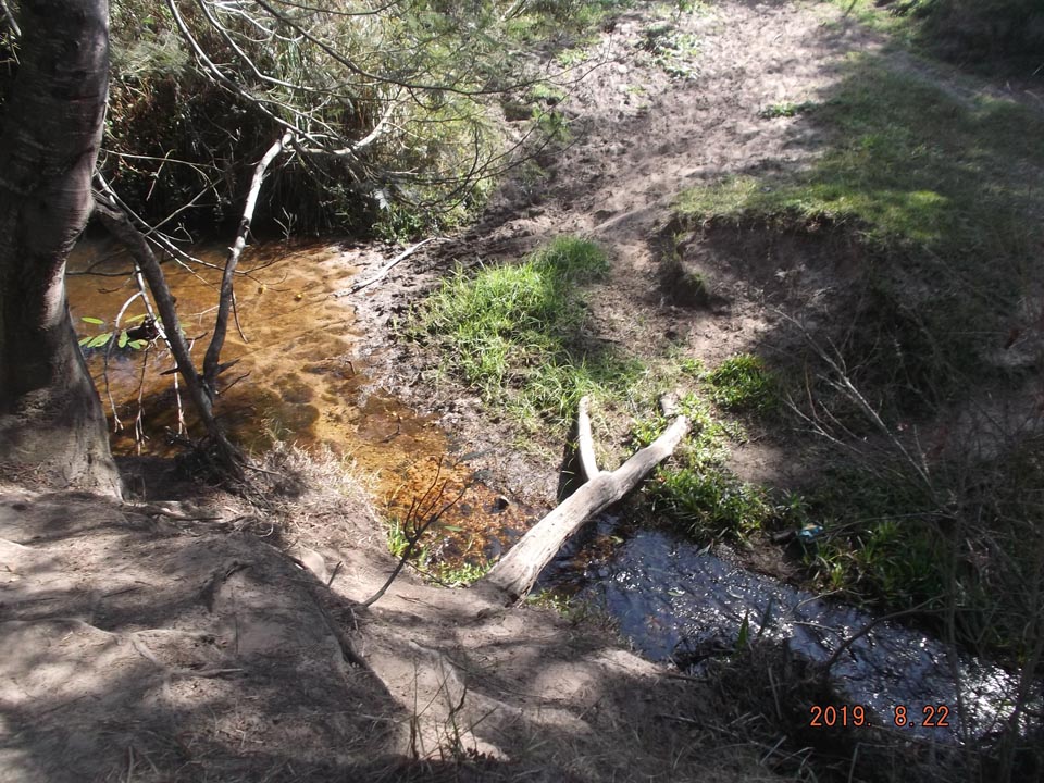
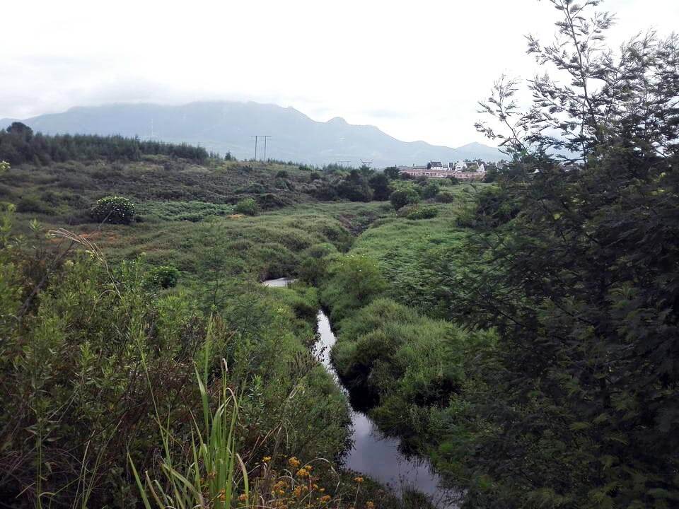
Rivers and streams
A river can be technically differentiated from a wetland in that it is a linear landform with clearly discernible bed and banks, which permanently or periodically carries a concentrated flow of water. A river is taken to include both the active channel and the riparian zone as a unit. Key features to look for when trying to determine whether a watercourse is a river or not is the presence of relatively discernible channel banks and/or a concentrated flow of water within a distinct channel.
Wetlands in South Africa are usually connected to rivers. The different reaches of a river are typically characterised by particular chemical, physical and biological conditions, but must be studies within a continuum along the length of the river. This notion of a continuum is a fundamentally important concept in understanding river function. Although rivers clearly change their characteristics with distance downstream, each river operates as a coherent whole. The processes and features of upstream reaches thus influence those in reaches further downstream and impacts in one reach can have effects that extend all the way downstream. When looking at cumulative impacts and ecological corridors, rivers must be seen as a continuous longitudinal ecosystem.
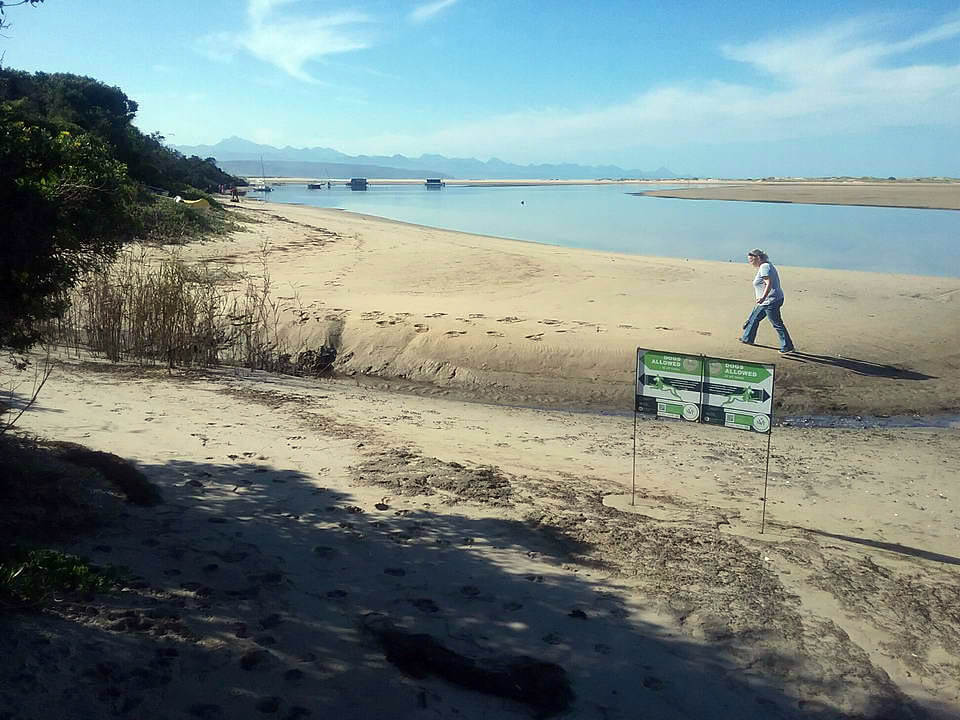
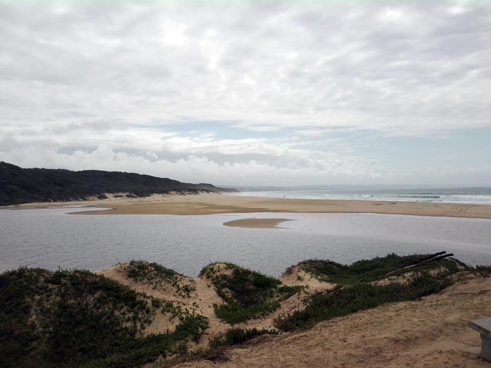
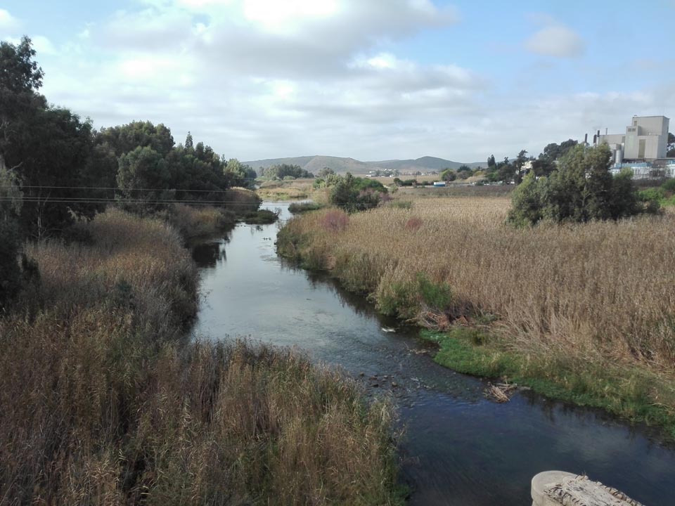
Estuary Integrity studies
In South Africa, an estuary is defined as:
“a partially enclosed, permanent water body, either continuously or periodically open to the sea on decadal time scales, extending as far as the upper limit of tidal action or salinity penetration. During floods an estuary can become a river mouth with no seawater entering the formerly estuarine area, or, when there is little or no fluvial input, an estuary can be isolated from the sea by a sandbar and become a lagoon or lake which may become fresh or hypersaline.” (Van Niekerk and Turpie, 2012)
Estuarine ecosystems are dynamic interfaces between terrestrial and marine environments that provide critical ecological processes and functions. They are highly productive systems and in turn supply invaluable ecosystem services to society. However, these important habitats, and the benefits they provide us, are increasingly threatened by anthropogenic pressures. Estuary management is therefore a continual challenge and likely to become increasingly complex with the addition of climate change variables. This necessitates integrated coastal management that is based on site specific, groundtruthed studies and monitoring to inform adaptive management strategies. Such strategies must include the management of the estuary mouth as well as the upstream river systems in order to be successful. SES undertakes estuarine habitat assessments in order to compile Estuary Management Plans (EMPs).

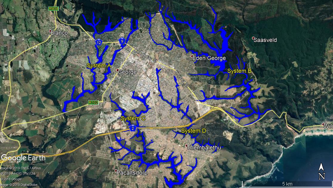

Spatial mapping and analysis using GIS software
SES uses GIS software to perform the following:
- Contextualization of the study area in terms of important biophysical characteristics and the latest available aquatic conservation planning information (including but not limited to vegetation, CBAs, Threatened ecosystems, any Red data book information, NFEPA data, broader catchment drainage and protected areas).
- Desktop delineation and illustration of all watercourses within and surrounding the study area utilising available site-specific data such as aerial photography, contour data and water resource data.
- A risk/screening assessment of the identified aquatic ecosystems to determine which ones will be impacted upon by the proposed development and therefore require groundtruthing and detailed assessment.